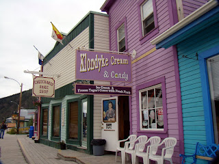
I awoke at 7am, it was cold and pouring down rain. I peered out the tent, and the visibility was next to nothing with the fog and cloud cover way down on the mountains. I decided to go back to sleep for another hour or two, hoping to give the weather a chance to break. Unfortunately, this would not be the case and at 10am, I was packing up in the pouring rain. Being unable to contact the rest of the group, we had made previous plans to meet up in Dawson City. One thing that came to my mind this morning, was that the road that came from Chicken to Dawson would be certain to be wet, slippery, and dangerous. Added to the fact that visibility was reduced down to 25 feet at times, so travel today is going to be very slow. After an easy border crossing into Canada, I started periodically calling for Woody and John on the Ham radio. By 11am, Woody answered me and said that they were leaving Eagle, but concerned about the conditions of the shelf road and would be about 4 hrs behind me. The amazing thing is that we were only about 80 miles apart and were able to keep in contact for the next hour or so. 3 hours later, I proceeded down the mountain at Dawson City, where a ferry boat takes you from one side of the river to the other. I spent about an hour in the tourist center and when I came back out, I was able to contact John who was only an hour behind me. We made plans to meet and have a very late lunch at Sour Dough Joe's. John and Tommy made it to Dawson City and we toured the town after lunch. Dawson City is another very cool town that will take you back to the turn of the century with genuine old buildings, old time signs, and modern day prices. If you saw my previous postings and pictures, you will understand what I mean by that. Prices here are quite a bit higher than what I have been used to. We left Dawson City to head to the Yukon River Lodge, just 26 miles away at mile post 0 of the Dempster Highway. We are looking forward to the trip tomorrow on the Dempster Highway, past the Arctic Circle, at the end of the road, at Inuvik, Canada.
Click on any picture to enlarge.
Saying goodbye to a cold, rainy, foggy, cloudy Alaska
The road to the border was muddy, rutted, wet and slick. Visibility was poor.
US Customs and Canadian Customs/Border Patrol on the "Top of the World Highway"
Top of the World Highway history
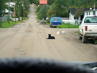
The Road to Dawson City 60 miles away was about as bad as it gets they told me
Ran out of gas a second time, this is my last can and its 30+ more miles to Dawson City
Finally, the sign that greets you to Dawson, but it is still 8-10 miles away
Dawson City from high above the west bank of the river
Yukon River View from high above
Scenes of and from the ferry including the dirt and rock ramp to the boat
Dawson City Pics
$189.00 for this fill up!
It seems as if every small town has a Sears Catalog Store, Dawson is not different and its in the gas station
We were told that this raft was featured in a movie with James Coburn going down the Yukon near Dawson
Old mining equipment litters the landscape east of Dawson
Acres and acres, miles and miles of piles of rocks and gravel, the spoils of mechanical dredging of the river and creeks
Our 1st Fox sighting
Our nights motel


Nice blog! Thanks for sharing this blog!How make it could u give me some suggestion actually i also want to create a new blog but have no any basic idea.Thanks.
ReplyDeleteClick Here
Interesting article you have shared.
ReplyDeleteLeo Muller